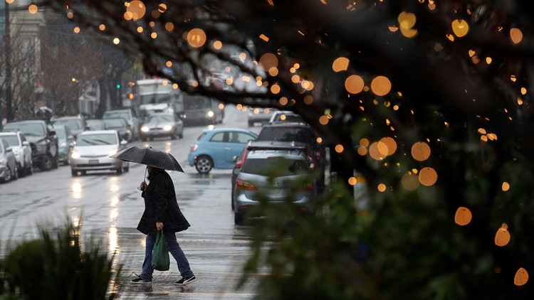
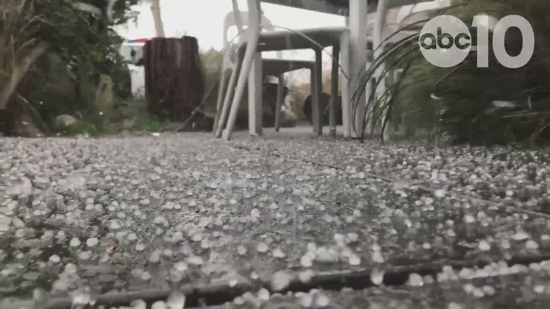
SACRAMENTO, Calif. — Authorities warn that mudslides are still possible Friday even after a damaging storm moved through California, trapping people in floodwaters, triggering a debris flow that destroyed homes, and forcing residents to flee communities scorched by wildfires last year.
Highway 26 between West Point and Glencoe is closed due to a mudslide.
The powerful system swept in from the Pacific Ocean and unleashed rain, snow and wind across the U.S. West into Wyoming, Colorado and Arizona after walloping Northern California and southern Oregon earlier.
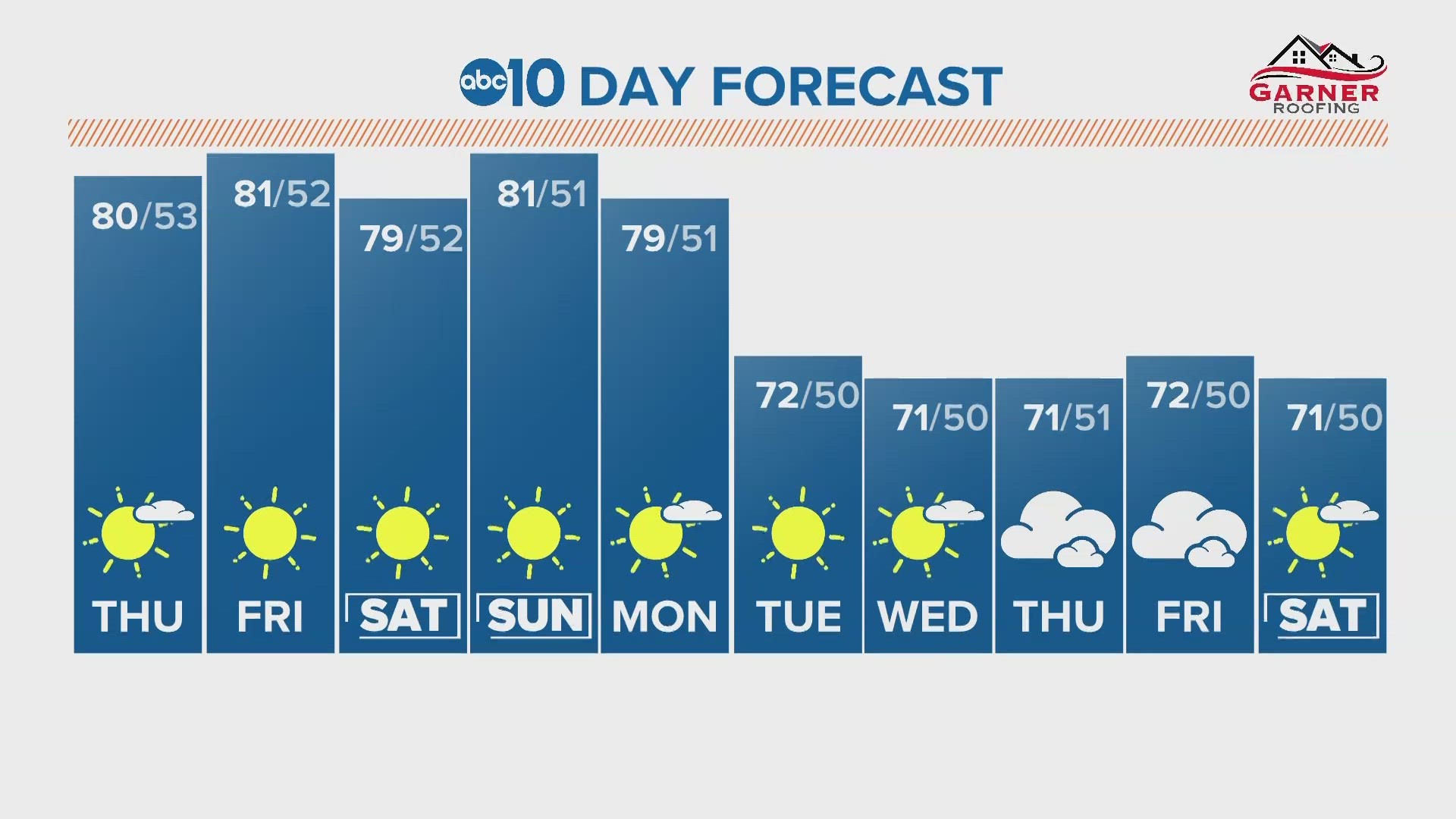
RELATED: Sacramento Local Forecast
RELATED: STORM TRAFFIC MAPS: Roads and highways around the Sacramento area impacted by rain, snow storm
Officials say Interstate 80 in the Sierra Nevada is closed Friday from the small community of Colfax to the Nevada border because of whiteout conditions. They say dangerous travel conditions will continue through early Sunday.
The area is expected to receive at least 3 feet (0.9 meters) of new snow.
The National Weather Service reported staggering rainfall amounts across California, including more than 9.4 inches over 48 hours at one location in the San Bernardino Mountains east of Los Angeles. Trouble also persisted in saturated Northern California, where thousands of people lost power and flooding was possible. Downtown San Francisco saw more than 1.75 inches of rain over 24 hours. Palm Springs recorded more than 3 inches of rain, only the third time that has happened in recorded history.
A flooded creek led authorities to urge about 300 residents to leave a community about 20 miles west of Paradise, a town destroyed last year by the nation's deadliest wildfire in a century.
The storm followed more than a week of severe weather in the Pacific Northwest and was the latest in a series of storms that has all but eliminated drought-level dryness in California this winter. It's fueled by an atmospheric river — long bands of water vapor that form over an ocean and flow through the sky. Formed by winds associated with storms, they occur globally, but are especially significant on the West Coast.
Nearly 37 percent of California had no level of drought or abnormal dryness, the U.S. Drought Monitor reported Thursday. About 10.5 percent of the state was in moderate drought, and just over 1.6 percent was in severe drought. The remainder was in the abnormally dry category. The numbers reflect data gathered up to Tuesday.
The storm delayed or canceled flights to and from San Francisco and Sacramento International Airport, closed sections of several key highways, including Highway 1 on the Central Coast, Interstate 5 north of Sacramento, and U.S. 395 in the snowy eastern Sierra Nevada. Wintry weather closed I-80 in California near the Nevada border and across much of Wyoming and sections of at least four other highways.
Associated Press writers Olga Rodriguez in San Francisco and Christopher Weber and Amanda Lee Myers in Los Angeles contributed to this report.
________________________________________________________________
WATCH MORE:
Rising river levels in Sacramento explained
Alan Haynes, a hydrologist with the California Nevada River Forecast Center, talks with ABC10's Carlos Herrera about river levels after days of rain in Northern California. Haynes also tells us what to watch out for.